Now, before getting to the images, I have to apologize in that there is no directional or other identifying information on the photos themselves. I'm pretty familiar with the area, so I didn't need such information myself. In the future I may try to plot out where Disney would have developed its facilities. For now, though, you'll have to rely on my verbal descriptions (expressed here as text). You may also wish to check out the Mineral King 7.5' topographic map (~17MB TIFF). (The main list of topographic maps is here should you wish to check out neighboring quads.)
We'll start off with an overhead shot of the valley, with north at the top.
 Mineral King Valley runs slightly north-northwest. The East Fork of the Kaweah River gathers runoff from the adjacent mountains in the valley and toward the top of the image begins to flow westward. The road to Mineral King follows the river. The Disney development in the valley would have mostly been confined to the northern crook, but ski lifts and even a ridgeline restaurant would have been distributed throughout the surrounding mountains. At its southern end, the Mineral King Valley becomes Farewell Canyon; Farewell Gap, at the top of the canyon, separates the East Fork Kaweah River from the Little Kern River. You can download a medium resolution (2452x2444) or high resolution (9809x9776) copy of this image.
I also have three oblique aerial images from various perspectives.
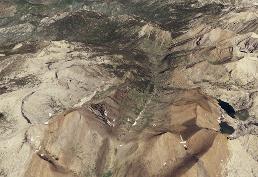 This first image is oriented north-northwest. Farewell Gap is centered at the bottom of the image and Farewell Canyon and the Mineral King Valley extends north from that. The Disney development, again, would have been at the far end of the valley, from this perspective.
 Here we're looking southeast. Farewell Gap's at the top, slightly to the right of center. (If you look carefully you can see a download progress bar; I guess I got impatient when I made these images a year ago!)
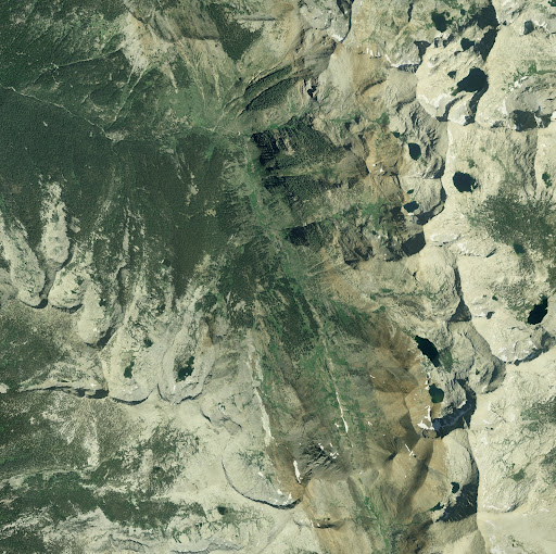
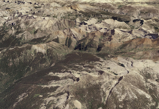 The final image is a bit further removed, oriented east-northeast. Extending up from the lower left is the East Fork Kaweah River. Mineral King Valley is in the center, though a bit obscured by the mountains. This gives some idea of the rugged terrain of the Southern Sierra Nevada.
If you're feeling a bit disoriented, feel free to leave a comment saying so, and I'll try to provide clarification!

2 comments:
What a great and informative post! Spectacular images, they make google-earth look like a playschool version! That would be neat if you plot out where the resort was going to be.
THANKS Professor Jason!
Mineral King valley will always represent home to me.My dog is buried there. It is both interesting and discomforting for me to see it in this way. As though my most private self were on display. Nice display though ;)
Post a Comment