Showing posts with label Mineral King. Show all posts

Friday, February 27, 2015

A Mountain Dream Come True

What are you looking at?

I have previously blogged about Mineral King, discussing my first visit there in 2005 with Bob Gurr, the way you can see it through aerial photography, and the 2009 designation of the valley as wilderness. I recently returned from Mineral King from my seventh visit, but this one was special--my first winter visit.

To refresh your memory on Mineral King: long a part of Sequoia National Forest, the area saw repeated interest as a potential ski resort. Fifty years ago today the United States Forest Service issued a development prospectus and later that year Walt Disney Productions emerged as the winning bidder. Disney bought private land in the valley and the company spent three years creating a master plan for the year-round resort. The Forest Service accepted this plan in January 1969.


http://www.mineralking.org/index.php/moment/february-27-1965.html

Many people believe that the Sierra Club is solely to blame (or credit) for the ski resort not happening. While it is true that the Sierra Club's lawsuit in June 1969 (against the Secretary of Agriculture and the Secretary of the Interior, not Walt Disney Productions) did delay the project, a primary reason the Disney ski resort (or any ski area) never came to Mineral King is the difficulty of getting up there in the winter. As I write in my masters thesis, the barely improved nineteenth-century wagon road did not afford year-round access. Putting a resort in possibly the premiere ski area in the world (a frequent turn-of-phrase in the development controversy) couldn't overcome the cost of modifying the road, or introducing a new transportation system.

Given my immense love of snow, it's only natural that I would want to be up in Mineral King in the winter. There are some privately owned cabins in the valley, which I assumed were inaccessible because of the Mineral King Road's closure from November 1 to Memorial Day. I knew people had gone up there in the winter, but I figured it involved miles and miles of cross-country skiing or snowshoeing, and then tent camping in the snow.

My experience, in comparison, was positively resort-like. In September I befriended Laile Di Silvestro, whose great-grandfather Arthur Crowley had patented land in the valley. This land later became a resort operated by Ray and Gem Buckman. The Crowley Cabin (built 1929) still sits on this land. One of the more interesting things (to me) is that it is actually on Disney property. Well before the prospectus was announced, Disney was interested in Mineral King and had surreptitiously purchased acres of private inholdings in and around the valley. The five-acre resort was prime property that could potentially put a stranglehold on any other developer's plans. Disney still owns this property, and much of it is the main parking area for valley hikes. As a result of my friendship with Laile, I was able to spend four nights in the high Sierra, on Disney property, surrounded by snow, and we had a national park to ourselves--all completely free. When's the last time you spent a free night on Disney land?

While on the Disney analogy, I must also mention that Laile seemed to me a premiere "Adventures by Disney" guide. An expert not only in the natural and human history of Mineral King, and in the nuances of this aged cabin, and in general hiking expertise and winter survival, Laile also anticipated everything we would need to enjoy our visit to the valley. And again, no surcharge for the service.

ABD Guide Laile

The outline of the trip's logistics was simple enough: Drive as far as we can on the road and then haul our supplies in on sleds the rest of the way. Before the trip I had been warned that we might be snowshoeing in as many seven or nine miles, and to be prepared to spend the night on the road(!)--mountain weather being what it is. However, given the terrible drought and horribly dry recent winters we've been having in California, we didn't have nearly this adventure to get to the valley.

We drove up the road as far as we could, which turned out to be about 22 miles up, leaving another three to walk in. Faculty Flat (named for the many academics who owned summer homes in the area long ago) tends to have some of the deepest snow through the winter because of the tree cover. We came to this steep, snow-covered slope and knew it was time to give up on the automobile.

This is not an all-year highway

Getting the sleds up to the cabin was an adventure. Other cars had made it a bit further up the road, so we had some tire ruts to deal with. The sleds had a mind of their own, and we spent a lot of time righting them. At least on the way up we had greater control over their speed. Near the end of our three-mile trek, once we got to the sunny valley, we encountered a bare spot on the ground near the bridge crossing the East Fork of the Kaweah River. These bare spots were more numerous and troublesome on our way out, after four more days of 50-degree temperatures had melted a significant amount of snow.

The Mineral King Road with iconic Sawtooth Peak in the background

As excited as I was to finally be in the Mineral King valley in winter, it was even more incredible to stay in what I consider the premiere cabin in the whole area. It even has its own webcam attached! The cabin is old, creaky, and drafty (read: literally freezing at night), but it has so much character and history. Propane for the lighting and cooking helped to keep the wilderness at bay, as did the stove we kept feeding firewood to. I mentioned the daytime temperatures being in the low 50s during my visit. Every morning, we so welcomed the sun hitting the cabin at 9:30. It instantly warmed, well, everything. Because of the high surrounding mountains and the low sun angle, however, the sun "set" at the cabin around 2:30 p.m. Our first day this meant we were off the porch and warming up inside.

Crowley Cabin, 1929


Morning view from the cabin's porch

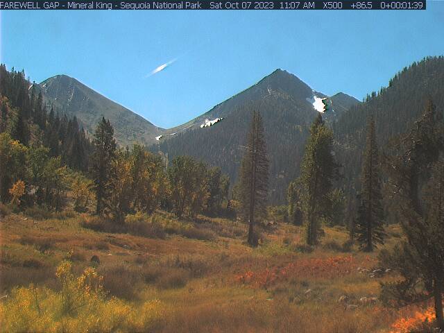
I mentioned the webcam. Here's today's view from the cabin.


There are actually four webcams in the Mineral King area, which we intended to signal from. The furthest down is at the private resort of Silver City. There we constructed a happy face out of some pine cones and pine needles.


We didn't make it to the Faculty Flat cam. In the Mineral King valley itself, there is the cabin camera (pointed toward Farewell Gap) and a camera on a National Park Service structure, pointing to Timber Gap. We'll get to the Timber Gap camera later. For the cabin camera, we came up with some ideas, but the first morning it was past 9 a.m. (the camera usually goes off between 9:20 and 9:30) and we had to do something, so Laile ran out and planted the American flag.


The next morning we took out two chairs, to plant ourselves in the view and have our hot beverages. The third morning we got ambitious and brought out a picnic table, made more difficult by the slushiness of the snow and how we broke through on each step while carrying the weight of the table. On the fourth morning, we felt we had done enough.

You might be wondering why I am not sharing all of these wonderful webcam photos that must have resulted from these efforts. As it turned out, we didn't know the camera's field of vision as well as we thought we did, and so for each of these activities we were out of the field of view. This is just as well, since it felt weird knowing we could be photographed at any moment.

Anyway, while we spent a considerable amount of time inside, we also took advantage of the placid winter weather to undertake a hike each day. The first two days we did five-mile roundtrips, with moderate elevation gain. The last day we did a more gentle exploration of the valley floor. You've already seen the many magnificent peaks surrounding the valley. The corollary is that when you go on a hike, there's no place to go but up, and everywhere you go offers a new perspective.

On our first full day in the valley, we went up to White Chief. The National Park Service describes it as "a steep but scenic hike up the west side of the Mineral King Valley." Steep it was. This marked my first time snowshoeing, but I picked it up pretty easily and enjoyed this new way to experience snow.


We arrived at the White Chief Bowl mid-afternoon, just as the sun was setting behind the mountains:


Our second day, to get some amazing aerial-like photos of the valley, we decided to head up to Timber Gap. The south-facing slopes had lost most of their snow, the exception being that the trail had many off-and-on snow patches (see photo of Laile above). Because I love the view toward Farewell Gap, I consider the Timber Gap trail one of the very best. The first part is rather steep (and in full sun), but offers ever-more-magnificent views with every step up. The trip required snowshoes only as we got under tree cover near Timber Gap. Laile led us out to a little west and above Timber Gap, near her favorite lunch spot. Sitting on the bare rocks, we were treated to a view that included not only the whole of the Mineral King valley, but also the Coast Ranges way out toward the Pacific Ocean.


The striking photo on the cover of Walt Disney Productions' Master Plan submittal in 1969, while taking from the air, was very similar to what we experienced as we had our late lunch.


Can you spot the cabin on the valley floor?

On the last day, I didn't have the energy for an 11-mile round trip to Farewell Gap and suggested that we instead hike toward the gap, but not take the trail to the top. This enabled us to tackle our signaling idea for the webcam pointed toward Timber Gap. We decided to stamp out a horse in the snow. Laile provided the artistic direction. The horse had a little bit of a paunch, but it ended up not mattering; the webcam only captured the upper part of the head.


The trip exceeded my highest expectations. (I had already grudgingly accepted that there was only a vanishing chance of falling snow.) I definitely look forward to future trips to Mineral King, including in the winter. Maybe I shouldn't even consider myself as visiting in winter until I've snowshoed nine miles uphill in a blizzard to reach the safety of the cabin (hopefully next winter!).

If you're interested in the thirteen-year development controversy, please consider following my Twitter account @SkiMineralKing. Until 2028, I'll be live-tweeting the 50th anniversary of the surrounding events. After 2028, you'll have to find other sources of entertainment.

Monday, March 30, 2009

Mineral King Wilderness

President Obama today signed into law the 2009 Omnibus Public Land Management Act. Among other things, the Act includes the Mineral King valley as part of the John Krebs Wilderness. McClatchy has a good article about the wilderness area and John Krebs.

Wednesday, May 7, 2008

Mineral King Aerials

Today we'll be looking at the Mineral King area from above. No, no Circle-Vision flyover here--just high-resolution aerials stitched together using NASA World Wind and National Agricultural Imagery Program (NAIP) photos. These 1-meter resolution images date from 2005, when the entire state of California was photographed. Incidentally, Google Maps/Earth uses a lot of NAIP images (shot from airplanes, not satellites) for rural areas throughout the United States. Your tax dollars at work!

Now, before getting to the images, I have to apologize in that there is no directional or other identifying information on the photos themselves. I'm pretty familiar with the area, so I didn't need such information myself. In the future I may try to plot out where Disney would have developed its facilities. For now, though, you'll have to rely on my verbal descriptions (expressed here as text). You may also wish to check out the Mineral King 7.5' topographic map (~17MB TIFF). (The main list of topographic maps is here should you wish to check out neighboring quads.)

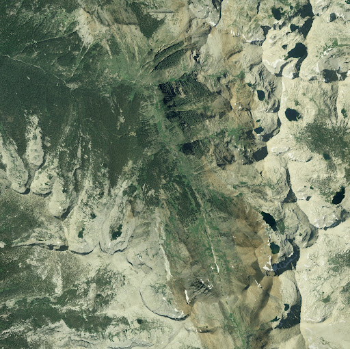
We'll start off with an overhead shot of the valley, with north at the top.

Mineral King Valley runs slightly north-northwest. The East Fork of the Kaweah River gathers runoff from the adjacent mountains in the valley and toward the top of the image begins to flow westward. The road to Mineral King follows the river. The Disney development in the valley would have mostly been confined to the northern crook, but ski lifts and even a ridgeline restaurant would have been distributed throughout the surrounding mountains. At its southern end, the Mineral King Valley becomes Farewell Canyon; Farewell Gap, at the top of the canyon, separates the East Fork Kaweah River from the Little Kern River. You can download a medium resolution (2452x2444) or high resolution (9809x9776) copy of this image.
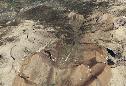
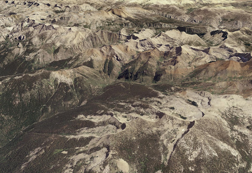
I also have three oblique aerial images from various perspectives.

This first image is oriented north-northwest. Farewell Gap is centered at the bottom of the image and Farewell Canyon and the Mineral King Valley extends north from that. The Disney development, again, would have been at the far end of the valley, from this perspective.

Here we're looking southeast. Farewell Gap's at the top, slightly to the right of center. (If you look carefully you can see a download progress bar; I guess I got impatient when I made these images a year ago!)

The final image is a bit further removed, oriented east-northeast. Extending up from the lower left is the East Fork Kaweah River. Mineral King Valley is in the center, though a bit obscured by the mountains. This gives some idea of the rugged terrain of the Southern Sierra Nevada.

If you're feeling a bit disoriented, feel free to leave a comment saying so, and I'll try to provide clarification!

Wednesday, April 2, 2008

A Mineral King Camping Trip

In September 2003, fresh from my "retirement," I took a week-long road trip throughout the State of California. One of my destinations was Sequoia National Park. While on CA-198 headed toward the park entrance, I passed the turnoff for Mineral King. Hey, Mineral King! I had heard about MK, but really knew very little about it. Ski resort and bears represented the sum total of my knowledge at the time. I filed the information away for later reference. While at the visitor center, I purchased a history of Sequoia-Kings Canyon National Park, The Challenge of the Big Trees by Lary M. Dilsaver and William C. Tweed (available for free online here). While Mineral King did not become part of Sequoia until 1978, its history is tied in with the park and so the area and its possible development as a ski resort are brought up several times.

The more I learned about Mineral King, the more intrigued I became. I also came to find out that the battle over improving the road to MK was a fundamental part of the whole ordeal (and you know me and roads!). I vowed to visit the area--sooner rather than later, preferably. And I knew just the person to act as my chauffeuer.

Bob Gurr and I share an interest in hiking and California. We went on a week-long camping trip along the San Andreas Fault in October 2004 and really had an excellent time. When I asked him if he were interested in this trip, I didn't know that he had worked on the project off-and-on for twelve years! Though he got several patents for the ski lift designs and was assigned to the road/alternative access part of the project, he had never visited Mineral King. We made our plans to visit June 30-July 2, 2005.

Since Bob had the Honda CRV (much more practical for camping than my car), he was the driver. He told me he's always enjoyed driving anyplace in the world--works for me! It allowed me to concentrate on taking photographs, anyway.

The road to Mineral King isn't too much better now than it was in the 1870s, when a toll wagon road was constructed for the mining activities occurring above the valley. The County of Tulare had long maintained it (excepting the relatively brief period it was a state highway in the 1960s), but it was by no means a high speed road. To its credit, it was mostly paved! But it winds ever higher into the Sierra, passing by the private inholding of Silver City before reaching the valley itself. We first stopped off at the campground to set up our gear. No reservations taken; first come, first served. We chose a campsite off in the back (the site, we later found out, most recently visited by a bear).

It had been a long drive and we planned to mosey around the valley, with a longer hike planned for the next day. As we drove up the road and passed one trailhead, I caught my first glimpse of the vaunted marmots of Mineral King. For whatever reason (perhaps the salt), these guys like to feast on car parts (belts, hoses) early in the summer. One recommendation to ward them off is to leave the car's hood open, but that didn't make sense to me. The thinking, I guess, is that they'd prefer to work in the dark; I think it just gives them more room to work, as seen below!

The general store in Silver City sells "fencing" to place around the base of the car, preventing marmots from getting into the car's machinery in the first place. I had informed Bob of the marmot menace prior to our trip and he brought along a large tarp; he drove onto it and we tied it securely, as so:

Since our hike planned for the next day was up to Eagle Lake on the western side of the valley, we decided on a short hike on the eastern side, as far as we felt like going. This visit followed a year of unusually heavy rains in Southern California, so even at this date the streams still exhibited considerable velocity in their flow. At the first such stream we had to cross, we stopped to survey it and determine the best place to cross. While doing so, we struck up a conversation with a friendly woman who was doing the same thing. After some talk about how this was our first visit to Mineral King, she said that she and her husband had a cabin in Mineral King. When I shared that Bob had worked on the Disney project, she gave us the cabin name and location and said her husband would really like to talk to him. We made plans to stop by at the end of our hike.

Our leisurely stroll only made it as far as Franklin Creek, which we decided would give us more problems to cross than we wanted to deal with. (Had we set our goal as Farewell Gap or points beyond, we likely would have pressed onward.)

This gave us additional time to explore the valley floor, however. While camping was formerly allowed and encouraged here (think decades ago), it has long since been pushed out of the valley proper to preserve the delicate ecosystem. After the time of the announcement of Disney's selection as the winning bidder for the ski resort (in December 1965) and before Mineral King's addition to Sequoia National Park (in 1978), the area hung in limbo. Greater crowds than ever came to see what all the fuss was about, but there were no extra facilities to handle them or additional funds to clean up after them. This is the view from the southern end of the valley:

On our way back to camp, we stopped by the cabin of the woman we had met earlier on the trail. Neither she nor her husband were there, so we continued on our way. The only thing of note from that first night that I recall is a possible historic first: Over dinner Bob and I listened to some of the "Bear Band" demos made for the proposed show for Mineral King (which became the Country Bear Jamboree). I think it's possible that this is the first time those demos were actually heard at Mineral King. We did not see any actual singing bears on this night or at any other time during our visit. (There goes Disney distorting reality again!)

The next morning during breakfast we had an unexpected visitor--the cabin owner had bicycled down to the campground and located us! He was fairly young during the time of the Mineral King development controversy, but remembers various events like a sit-in performed in the valley. Because of his personal experience, he was very interested to hear Bob's knowledge of the project. They also talked about Robert Hicks, an economist from the Stanford Research Institute hired as the project manager for Disney. I think he still owns a cabin in Mineral King, which is how our cabin friend knew him. We were offered a tour of our friend's cabin if we showed up after our hike, so we put it on our list!

Our purported goal for the day's hike was Eagle Lake, but we were willing to turn back if that seemed unobtainable. The day was much warmer than we had expected, but that made the temperature perfect. The trail gradient was excellent. I think we hardly saw anybody else on the trail (excepting a deer and her fawn, who went right down the hill on our trail). As we got into higher elevations, we started to see more patches of snow. We then encountered this magnificent site of a field of snow beneath towering granite walls:

We hiked to the top of the snow and had our lunch looking out over a gorgeous vista of Sierran peaks. The continuation of the trail was virtually indistinguishable after that point and we were satisfied with our hiking accomplishments. We got our promised tour of the cabin--constructed in 1931 on the site of an old miner's cabin--and had an enjoyable conversation with the residents. My favorite part of that was when the man said that he'd like go on a tour of Disneyland with me. "Actually," I replied, "I've co-authored two Disneyland trivia books, one of which is called 101 Things You Never Knew About Disneyland and points out things in today's Disneyland..." "I think I have that book!" his wife exclaimed. That's still the only "stranger" I've encountered to have one of my books! The sleeping arrangement of the kids outside on the deck reminded Bob of spending time at a family cabin in Idyllwild. Also on the way out from the hike I got my favorite photograph of the Mineral King valley, looking south toward Farewell Gap:

The next morning we drove up to the valley one more time for some last looks and photos (the marmots were out sunning themselves) and then made the long, winding trek back down the Mineral King road. On the way out we followed a car with a "Save Disney" bumper sticker--a sentiment I found terrifically ironic in Mineral King.

More photos are available from June 30, July 1, and July 2.

I'll have more reports on Mineral King in the future. I've done extensive research on the project and collected quite a few sources--it was a very long, very public effort to develop the Mineral King valley for winter recreation. I'm writing about it for a research paper right now and for eventual incorporation into my master's thesis, so I hope to be able to use some of my writing for "double duty."